Google Maps shows Romanian Route 66A in the same colors and size as any of the other well-paved highways in the area. On a map it looks delightful – continuing from the route we rode in on yesterday, the road bisects a natural preserve and wiggles around a lake before climbing up and over a pass – our first Romanian pass!
Our first hint otherwise came last night when we noticed a pair of cycle tourists outside our guesthouse as we went down to dinner. We went out to greet them as they considered stopping for their meal, and asked if they’d come from the direction we’d be heading. The woman pointed to her mud-splattered shoes and told us only cars should go there. They didn’t seem interested in talking with us further.
Undeterred, we asked the waiter at dinner whether there was a market further that way, and he showed us one on the map that was off of 67, a road that forks from our looks-like-main-route-north course. We said instead we’d be going directly north, not forking, and he replied that our route wasn’t really a road and reminded us to pay in the morning before leaving.
Still undeterred, we slept (damply) until 8, when at breakfast we met some Spanish motorcyclists who’d come in from the way we’d be leaving. Asking them they assured us that the first 20km were bad, but then the road got really nice.
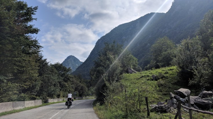
Always preferring the good news, we chose to believe the most recent report, and set off happily, briskly scampering up the first few kilometers. Indeed they were beautiful, as the road continued alongside the river, following a deep gorge with steep cliffs providing shade on either side.
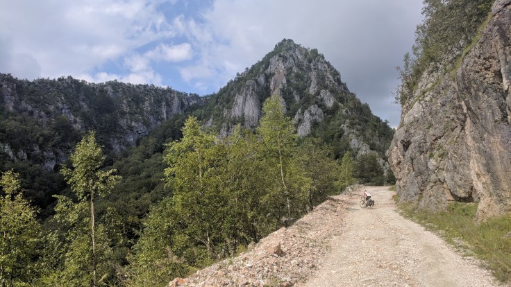
When we arived at the fork, coincidentally at about the 20km mark that the Spanish men had mentioned, we could see a bit of the folly of our ways. We pulled off onto the gravel side, toward the direction that a roadsign marked as not advised, and settled in for a slower pace but assuring each other that this was still reasonable and wondering where those cycle tourists could have acquired all that mud.

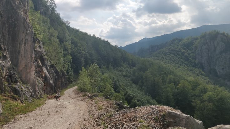
Twenty kilometers later we were lucky to both still have dry feet, as we cruised through the center of, or wiggled to avoid, huge puddles, swaths of mud, and pits of sand on the dirt road. We pulled over for a lunch (Philipp eager to be relieved of yesterday’s watermelon purchase) and two German motor cyclists stopped to ask if we knew for how long the road continued like this and said one of them had already slipped out in the mud, and had only a half a tank left.

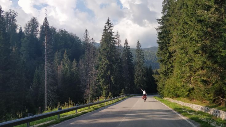
We did wiggle our way around the rest of the lake, and then settled in for the remaining 500 meters of climbing, along similar roads, to the peak, which is then just 6km away from our glamping/camping site. We acknowledged the beautiful scenery at the top but ground on, as downhill rocky roads can take as long as uphill.
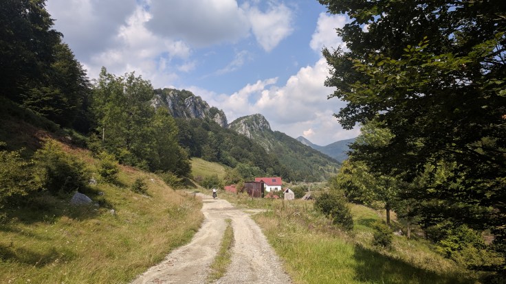
As we neared the end of the descent, a pack of dogs descended on me. Luckily these weren’t the wild sort, but belonged to two farmers gathering dried grass. We’d been warned about several tactics for dealing with wild dogs, including fake and real stone-throwing, and water guns. I chose speed as my evasion tactic, unadvisable as the dogs actually like the chase, but a nice driver headed out from his campsite provided some honking which let me go free.
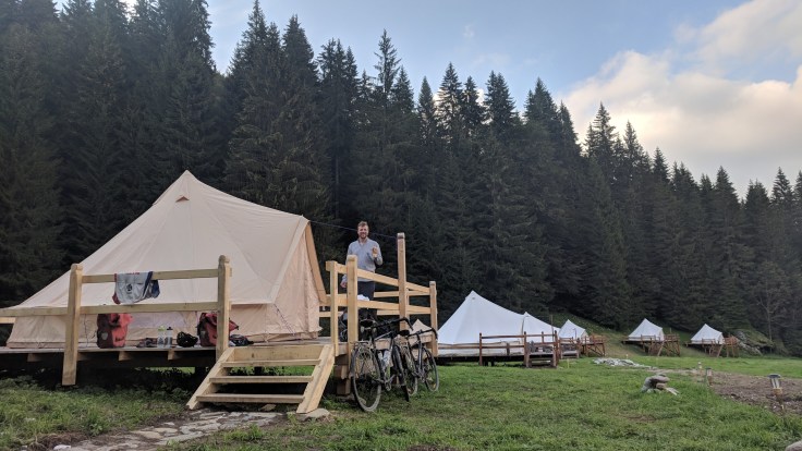
Some eight hours after starting we rolled into our glampsite, and the lovely couple running it helped us help ourselves to a radler and a shower before grilling up enough food for four. We ate nearly all of it, and retired to our cosy tent, filled with pristine IKEA beds and bedding, and a heater. We were happy about the cooler temperatures and the safe end to a long day, and still felt thankful for the pivot away from the hot and flat.
Total distance/elevation to date: 5266km/43’798m
Rest days: 18
Route and Stats
Relive Video

Leave a comment