Day 42: Avigliana a Azzano d’Asti

img_20180706_155014
“Choosing gelati!” or “The hardest I had to think all day”

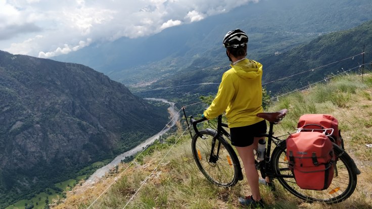
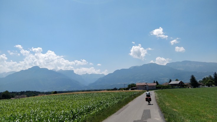
Today was the first of three days we sketched out using bicitalia.com to get us to a beach south of Genoa for a longer rest. It was going to be 105km (65 miles) of flat, and potentially boring, and definitely hot riding to traverse the flat section of Italy between Turin-ish where the Alps empty out and where the mountains pick up again before the coast.

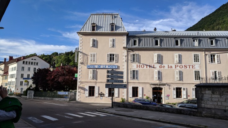
The morning’s breakfast – our first in Italy – exceeded expectations with respect to ambiance and view, and the food was as exceptional, and non-German/Asian/American, as we were warned in the welcome e-mail:

Our breakfast consists of homemade cake or “brioches” (of which our daily selection depends from our suplier), homemade bread,  cheese, eggs freshly cooked (upon request), homemade jam, butter, biscuits, cereal, muesli and Nutella. We don’t cook bacon, sausages, fish, potatoes, noodles etc etc. because they  are not part of our traditional breakfast.

Welcome to Italian food rules.

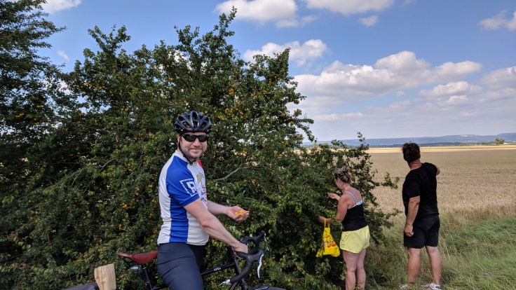
Our plan was to stick as closely to the suggested bicitalia route as possible, to learn whether we liked their suggestions and could continue blindly using them for routing as we’d done in France (geovelo) and the UK (sustrans).

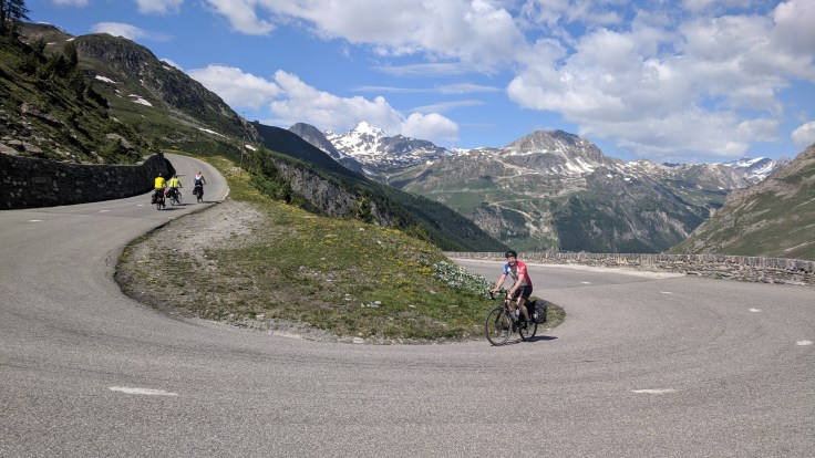
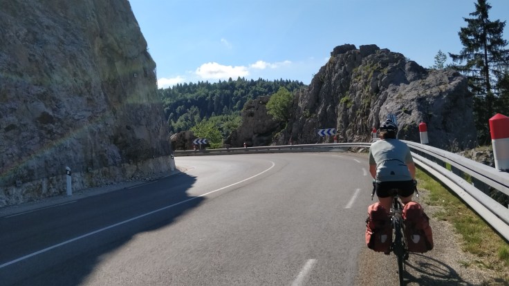
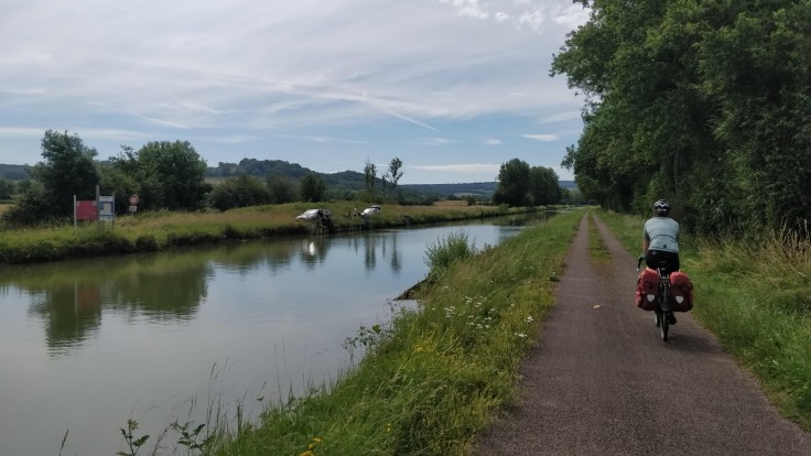
The first 30 km (19 miles) were a mix of excessive avoidance of state highways and one long-ish stretch of dedicated cycle path. I’m always curious what the sensitivities of these routing algorithms are, and what type of rider they are optimizing for. In our case we’d sometimes prefer the state highways in lieu of a 10-15% increase in total distance which favors back roads, but concede that not everyone is out here for five hours at a stretch and for some that may in fact be working as intended.

img_20180706_114024
Some nice bits and my new, breezier, top!

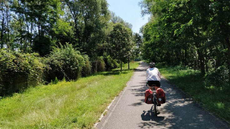
At some point someone had put a lot of effort into cycling infrastructure in the area, but it had gotten neglected, with overgrown brush and faded paint. Some intersections even had dedicated crossing lights for bikes, but after a few too many zig-zags through busy neighborhoods and watching one driver blow through a green cycle light I was pretty ready to abandon the proposed route in favor of the direct one.

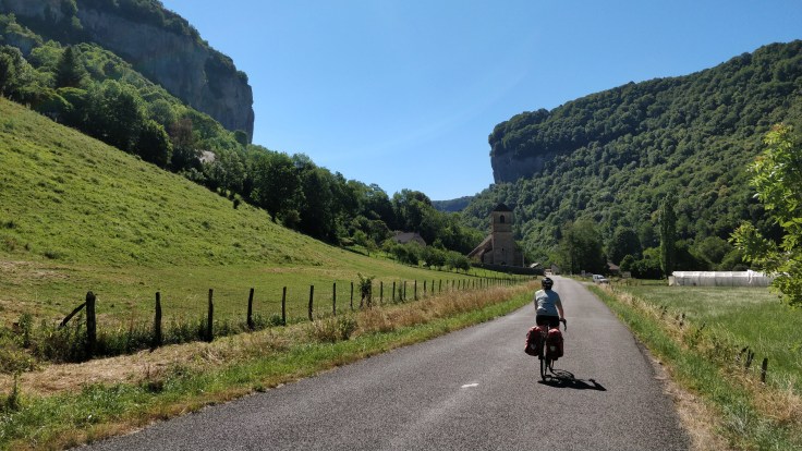
Had good results from our first trial of the Italian lunch plan – a quick 5each pasta stop in lieu of the French baguette and cheese and veg picnic – and we were off on an updated, more direct route that’d save us 15 km (9 miles).

img_20180706_135324
Busy, but direct, routes

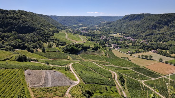
Made good time over the next 40 km and rewarded ourselves with a gelato, the aftertaste of which was nearly enough to get me through the bonus 1 km (0.6 miles) of climbing to get to our agroturismo. Nearly.

Arrived to tales of how yesterday’s storm was actually hail up here, and we could see extensive damage to the grounds and canapes over the terrace. Luckily the owner’s farm is further down the valley, and production of their eggs, fruits, vegetables, and wheat was unaffected. Someone explained once that agroturismos in Italy are largely a tax-evasion scheme, with frequent violations of the requirement that owners make a larger portion of their income off agriculture than off guests, but this one seems to have an earnest focus on the farming.

Enjoying a glass of the owner’s uncle’s white wine next to the fig and pomegranate trees while we do some more critical reviews of bicitalia’s plans for us for the next few days, and getting hungry for dinner.

Total distance/elevation to date: 3207km/23’879m
Rest days: 10
Route and Stats
Relive Video

Day 41: Mont-Cenis a Avigliana

img_20180705_113950
Boungiorno Italia!

We both had a rather restless sleep last night for some reason. Maybe the high elevation at 2080m/6800ft, or maybe all the climbing (about 1200m/4000ft per cycling day since Geneva) is taking its toll on our bodies. Whatever the cause, we were happy that today would be rather easy: We would roll down from Mont-Cenis to the Susa valley, losing 1500m/4900ft over 25km/15.5 miles, and then roll on a smaller negative gradient to a B&B near a lake and go for a nice swim.

The easy route allowed us to take more time in the morning and we strolled to the nice exhibition-garden about the alpine flora near the hotel.

img_20180705_105742
Edelweiss, and I forgot what the yellow flowers are called
img_20180705_110405
The pyramid-shaped church near the alpine garden. The odd shape was, I think, inspired by a Dutch entry for a design competition for a monument for Napoleon on Mont-Cenis. The monument was supposed to be 100x100x100m (330x330x330ft) – the church is considerably smaller.

On the long downhill, we took several breaks to relax our hands tired from constant braking, and to take in the scenery.

IMG_20180705_112447
Looking back at the Lac du Mont Cenis – me in the curve
img_20180705_1157191
Overlooking the Susa Valley

With about 14km to go, we spotted a post-office where we could mail some postcards that we wrote. Getting stamps at an Italian post-office is not that straightforward, it turns out: First, Liz got help from lady A to get the correct queuing ticket (Liz was the only one in the post-office, ironically). The ticket then got her to the counter of lady B, which then referred Liz back to lady A. When lady A punched in all the data of the postcards, the stamp printer produced a sticker almost the size of the postcard, after which Liz requested regular, smaller stamps. This required lady A getting the assistance of lady B, because the only stamps in stock did not have the correct valuation (the price is not 0.90€ anymore, but 1.15€). Ladies A&B eventually sold Liz three stamps to add up to the required value, at which point the required surface area for postage on the postcard was almost back to the original ginormous printed sticker. I was waiting outside and checked in from time to time, wondering what could be taking so long.

By the time the postcards were mailed, rain set in, which turned into torrential downpour close to the hotel. Drenched, we opted for warm showers instead of the swim in the lake.

img-20180705-wa0002
Not the way I wanted to experience water today

Total distance/elevation to date: 3117km/23’534m
Rest days: 10
Route and Stats
Relive Video

Day 40: Chalet Colinn à Mont-Cenis

img_20180704_121242
On top of the highest pass in the alps!

We had a good rest day at the Chalet Colinn overlooking the Lac du Chevril, a reservoir for a hydropower plant. The owners, Elizabeth and Mylène, are wonderful hosts and we felt more like staying with good friends than in a hotel. So much so, that on our ride today, we were thinking of ways to go back for a hiking or skiing trip.

Mylène told us about the crazy story of how the two of them bought a house in ruins, and then spent several summer seasons to build the chalet in the traditional style and technique with lots of help from a seventy-year-old, retired stonemason. Besides being a great host, Mylène is also a great chef and made the most delicious Tartiflette we had so far, a local specialty.

img_20180704_093422
Mylène

We used part of the rest day to service our brakes. The brakepads got thinner from all the downhills and we had to readjust spacings so that the brakes would be responsive again. The pads on my bike were so worn down that I decided to replace all of them.

IMG_20180703_104109.jpg
Most scenic bike maintenance session

While we were servicing our bikes, we listened to stories about the bike travels that Elizabeth did when she was young: On a tour to the Black Sea and then down to Istanbul, she would start the day before dawn to avoid the heat; and on a trip to the North Cape she found that the only place to stay safe from the millions of mosquitoes was either moving on the bike or underwater in a lake.

img_20180704_094115
Elizabeth

After Liz explained our motivation for the bike trip, Elizabeth phoned her friend at the Val d’Isère TV and radio station, and we promptly got interviewed, in French, which was a bit of a struggle. Here is the video!

IMG_20180703_153539_1.jpg
What a backdrop for an interview at the Chalet Colinn

Last night, Mylène made fish and spaghetti to fuel our legs for the challenging climbing day today: We first rolled down to Val d’Isère to meet Valentin and Thomas at the TV and radio station so that they could film us rolling off toward the first pass of the day, the Col de l’Iseran, which is the highest mountain pass in the alps at 2768m (9068ft). Due to this fact, it also opened just ten days ago, which is lucky for us!

The climb went very well, and we saw many other cyclists, probably due to the fame of the l’Iseran.

IMG_20180704_110738.jpg
The three French men in front of me are doing a mountain pass tour. They carried all the gear for camping, which must make climbing the passes all the more difficult, chapeau!
IMG_20180704_123156.jpg
On the downhill, we passed tall walls of snow at the top.
img_20180704_123004
Climbing passes is hard, but it pays off with beautiful scenery.

We were starting to get hungry, and in Bonneval-sur-Arc at the foot of the pass, the boulangerie was closed, so we only bought some locally made goat cheese and hoped to find an open boulangerie in the next town. No luck, so we did what we usually try to avoid and had lunch in a restaurant. Of course, we both ate too much and regretted it for the next kilometers to the foot of the last pass of the day, the Col du Mont-Cenis.

This climb seemed harder, either because of the lunch or the elevation we already had in our legs. Counting down the kilometer markers to the top, we eventually made it and were rewarded again with a stunning panorama over the Lac du Mont Cenis, where we booked our last night in France. Tomorrow, we’ll roll down to Italy! Pasta and amazing coffee, here we cooooome!

IMG_20180704_155227.jpg
Most passes we climb in the Savoie have these markers for cyclists indicating the distance to the top and the average grade for the next kilometer.
IMG_20180704_162802.jpg
View over the Lac du Mont Cenis

Total distance/elevation to date: 3056km/23’388m
Rest days: 10
Day 40 Route and Stats
Relive Video

Day 39: Col de Méraillet à Chalet Colinn

img_20180702_091355
Evacuating this valley for the next

Managed an early rise, just before alarms echoed across the reservoir to evacuate all rivers, with instructions given in French and Italian, we assume due to upstream letting out of other reservoirs. Were joined at breakfast by all the other (motor) cyclists in the lodge – was surprised to see riders with such horsepower bothering to get up early, but I suppose we’re all vying for the same empty asphalt.

Managed a luxurious climb to start the day, with few cars or motorcyclists and much of it still in the shadow of the mountain. The last kilometer of the first climb was a gentle gradient amongst stunning wildflowers.

IMG_20180702_095804.jpg
Philipp photobombs pretty wildflowers

Then plummeted 1100 meters (3600ft) down, while the temperatures climbed, to Bourg-Saint-Maurice, where we stocked up on lunch foods for today and our rest day tomorrow. Faffed about, as our English friends say, at a few cycle shops looking for better water bottles, and I bought a new long-sleeve white shirt to complete the transition of my look away from “sporty spandex” toward “is this a beach holiday yet.”

IMG_20180702_102007.jpg
Descent before the rescent

Back up a wee false summit, which Philipp had ingeniously designed to get us away from the main road, snack, and slight descent to kick off the final relentless 850 meter (2800ft) ascent toward Tignes along what seemed like the main trucking route.

Both this and the ascent to Roseland were marked every kilometer with signs for cyclists, counting down the kilometers and providing the average gradient for the forthcoming segment, but we saw far fewer other riders today – a likely symptom of aforementioned truck traffic. That said, we agreed our preference was to share roads with trucks, whose drivers are professional and give wide berth, over splashy sportscars for whom all curves must be hugged – regardless of cyclist occupancy.

IMG_20180702_150448.jpg
Trucks + Reservoirs

Dreams of a swim were dashed as the reservoir proved more of the active industrial sort, so we booked the last 3 kilometers up to our rest day hideout, a stone cottage overlooking the water with a terrace surrounded by beautiful flowers, just in time to beat the storm and listen to thunder roll in. If I never write again, send wine care of Chalet Collin.

IMG_20180702_154542.jpg
Seeking shelter from the storm

Total distance/elevation to date: 2991km/21’715m
Rest days: 9
Day 39 Route and Stats
Relive Video

Day 38: Megève à Col de Méraillet

IMG_20180701_192717
Tartiflette = posh mac’n’cheese

The most important thing about this post is that it is being written overlooking a lake and beautiful mountains while we are drinking chartreuse. If you really need more details, more about the day is below.

Short night last night but the heat motivated us to roll out (and up) “early”. We had a 7KM cruise to wake the legs up before the first 600 meter climb. Philipp sped off with some headphones and my warning of cycling safety whilst wearing headphones, and I was left to reflect on why my odometer wasn’t moving fast.

IMG_20180701_104240.jpg
Brief overtake of speedy Philipp

Sneak peaks of high alps provided another distraction, and we reached the first “summit” fairly quickly. We’ll be laughing about this as a “summit” in a few days, once we reach said high alps. Tested the breaks back down to below the original altitude – descents can be incredibly frustrating when you know you have more climbing to do, and sketchy road sections and break hand pain mean you can’t look around much, but a good reminder that we’re supposed to be having fun. This is fun, right?

IMG_20180701_121729.jpg
“Fun” brake test with views of Mt. Blanc – me at left

Speaking of fun, chatted to some other cycle tourists who were doing a loop around the Mont Blanc, with trailers and what looked like camping gear. I love all the impressed “bon courage” or “allez allez” remarks we usually get with our two paniers, but nothing like a full set of gear to remind us how luxurious our trip is.

Back up a false summit for lunch, which Philipp kicked off by tossing his sunglasses into a waterfall. I heroically scampered down to rescue them, sadly without Strava so under-estimating my total elevation for the day. Triumphantly returned and finished off some aging baguette, cheese, olives, and cucumber that I’d dragged up the first peak. Cookies and a peach provided the sugar rush for the next 900 meters of climbing, where I tested podcasts as a means of distraction. No headphones as I like to hear the traffic coming, so was blaring it out of my pocket, but another American cyclist passing me recognized it and commiserated at the grueling switchbacks, saying he had likewise turned off his computer due to it’s incessant reminder of how slow you are up these hills.

Philipp raced some other gents up to our hotel, a no doubt infuriating experience to riders with no touring gear but much farther to go before the end of their day. Boys. Arrived in what seems like paradise, a half-board (breakfast and dinner included) mountain hotel with views onto Lake Roseland. A nap got me ready for the full-on mountain dinner of scalloped potatoes in cream and cheese and cured meats, and now digesting with a purely intellectual exploration into the difference between Genépi and Yellow Chartreuse.

IMG_20180701_202033.jpg
Is this hotel view stunning or is it the Chartreuse? 

Total distance/elevation to date: 2936km/20’174m
Rest days: 9
Day 38 Route and Stats
Relive Video

Day 37: Genève à Megève

img_20180630_122703
Heading toward the French Alps. Some climbing ahead!

We started the day at 9.00, meeting my mom and cousin in the lobby to go for coffees and croissants at a cute, little coffee shop nearby (even with the 50% off vouchers, the hotel breakfast would have been CHF14/person). While we had nice lattes, fresh orange juice and croissants, we tried to think of Swiss politicians that were infamous for scandals that they were involved in. We could only come up with a manager of a smaller Swiss city that sent nudes to his mistress taken in his office in city hall, and the (Texan) wife of the former Swiss ambassador to Germany who had some “revealing” pictures taken for a German magazine on the property of the Swiss embassy in Berlin. “Amateurs”, the current American president would say, probably.

Then we said our goodbyes to my mom and cousin and were off. After just a little bit of city traffic, we hit a newly built greenway leading out of the city which was very nice.

img_20180630_110821
Could not leave Geneva without taking a picture with the Jet d’Eau

At some point cycling on the greenway, we must have left Switzerland again, as we suddenly found ourselves in Annemasse, a French town. No border marker. By then, the temperatures already reached at least 30 degrees (86F) and we started going through our water supply rather quickly (we now each carry three liters (0.8 gallons)).

A stretch of the road on our route was closed for construction and the detour suggested taking the highway for a little while, so we had to do some construction-site offroad cycling to stay on course. We saw some bike tracks, so were not the first ones to opt for this approach.

IMG_20180630_114629
Short offroad section today

After this, we made very fast progress on the almost flat approach to the day’s climb starting in Sallanches. The 500m (1640ft) climb was tough in the hot weather, but the nice views onto the Mont Blanc range partially made up for it.

img_20180630_151631

When we reached the hotel, we were drenched in sweat and our water bottles were all empty. But we were greeted by our friend Mathieu from Zurich, who was spending the weekend in Chamonix and drove over to see us! We showered quick to go to the bar for the locals (good recommendation by the hotel owner), where it is accepted to buy something from the nearby boulangerie to consume it with one’s drink. Besides catching up with Mathieu, we followed the great France – Argentina game of the World Cup, and the locals started chants about Messi having to go home after the “Bleus” beat the Argentinians.

After walking through town, we walked with Mathieu to his car, but the 50 steps to get there were hard with our tired legs. After goodbye hugs, we went to dinner. Megève is the fanciest of ski towns in the French alps and has no fewer than six Michelin Star restaurants and many expensive clothing stores. We went to a not too fancy place for dinner, but still paid 90€.

Back at the hotel, we very quickly fell asleep. Other people were making full use of the Saturday night, though, so we had to put in earplugs at around 2.00 in the morning to be able to continue sleeping.

Total distance/elevation to date: 2883km/18’583m
Rest days: 9
Day 37 Route and Stats
Relive Video

Day 36: Morez à Genève

img_20180630_105244
My cousin and my mom traveled all the way to Geneva to see us!

Last night in Morez, we were too late to eat at the bistro with all the locals. They had a moule et frites night and were fully booked. The other options were either take out pizza or doner kebab. We went for the latter and it was quite tasty and came with soccer on Turkish TV.

We did go for a nightcap at the bistro though, and had a nice Macvin, my new discovery in the Jura, and pastis, Liz’s go-to drink here in France.

IMG_20180628_192453.jpg
Before dinner, we walked to the hotel where Anne and Reece had stayed at the time! It is still around! The Google Maps reviews were not great, though, so we stayed in the other option in town. From one of the reviews: “Terrible experience. The rooms looks like something that hasn’t been updated or cleaned since the 2nd world war.” Sounds like we opted out of a potentially authentic 1948 experience.

After instant coffees at the hotel, we did the usual croissant and pain au chocolat breakfast at a boulangerie and then headed out on today’s relatively short ride of 60km to Geneva. And we started quite early at around 9.45, probably a new record on the trip.

Right out of the gate, we hit the climb up to Les Rousses, climbing about 500m (1600ft) over 15km (~9 miles), so not too bad. On the climb, I sang my classics to entertain Liz: the Swiss, American, and German anthems, and then I looked up the lyrics to Mani Matters “Alpeflug“, a song I like a lot and should really learn the lyrics to.

img_20180629_100602
On the climb out of Morez, we turned off the main road, the N5, soon after this picture and got on a much quieter road.

Up at Les Rousses, we traversed a nice, green plateau to La Cure, where we entered Switzerland. No passport or Macvin allowance controls.

img_20180629_105219
Between Les Rousses and La Cure

The biggest immediate changes of entering Switzerland were:

  1. Very nice roads.
  2. The water is drinkable from most fountains compared to the usual “Eau non potable” disclaimer on French fountains.
  3. Pastis is not ~2€ like in Morez or Domblans, but 7CHF (6€).

After La Cure, we soon reached the Col de la Givrine, a small pass, after which the long descent to Lake Geneva started. We rolled through Saint-Cergue and then down quite a steep and serpentiny road toward Nyon.

I think Anne and Reece took the exact same route: “From the border we pumped up a little further to the top of the Col de la Givrine (1211 meters), where we could look across the haze obscuring the valley at the snow covered Alps south of the Lac Leman (Lake Geneva). From this point we coasted all the way into Nyon, with much use of the brakes to keep from flying off the ends of the hairpin curves.”

img_20180629_111003
On the pass! It got either higher or the measuring standard/technology changed since 1948.
img_20180629_113342
Hazy view from the hairpins below St. Cergue over the Lac Leman

Unlike Anne and Reece, we did not ride all the way to Nyon, but stayed further away from the lake to follow the bike route 50. Soon after the descent, we had a picnic lunch where I sat on a wasp that promptly stung me. I haven’t been stung in a while and yup, their stings do hurt.

We made very good time and were already at the hotel near the Geneva train station at 14.00. On the last kilometers, Liz and I talked about the fact that this was the last cycling leg that Anne and Reece did. After Geneva, they continued traveling by train. We were feeling both sad that our ride on their path would end here, and thankful that their trip inspired us to go on such a great adventure.

Arriving at the hotel, our room was not yet ready, so we headed to the bike repair shop to take care of my broken spoke. Liz waited with a 7CHF pastis in a nearby cafe while I arranged with the nice man at Péclôt 13 to replace my spoke until 18.00 and to give me four extra spokes for each side of the wheel. I was thinking that this would be a good solution given that the wheel was fine for dozens of kilometers with a missing spoke, and we would not have to search for bikeshops when more of the spokes go.

We then went back to the hotel to check in. Since the my cousin and mom’s train got delayed, we had time to go for a cool-off swim (it was a hot day!) in Lake Geneva. We went to the nice Bains des Pâquis a short walk away from the hotel, where CHF 2 gets you in (in Zurich, the swim places cost CHF 8 at the lake!).

While Liz enjoyed the sun and water a bit more, I went to pick up my mom and cousin from the train station to walk with them to the hotel. At check-in, they almost did not let my mom stay at the hotel because she did not carry an official license. The monsieur at the reception was not too nice about it, either, and muttered something about the obligation to carry identification in Switzerland. We checked, and there is no such thing. Anyway, we got the room in the end.

From the hotel, my mom and cousin joined me to pick up the bike, and we spent the time until 18.00 in the cafe near the bike shop with drinks and catching up. Unfortunately, when I got to the shop at 18.00, my bike was still not done, but they promised the fix until 19.00. More drinks!

When I got back to the shop at 19.00, the mechanic looked concerned and told me that he has to sell me a new wheel. After he replaced the spoke and was truing the wheel, another two spokes snapped. Chatting to the mechanic while he replaced the whole wheel, I learned that I introduced Liz to everyone in French so far as my “mari”, which means husband. Eight years of French education in school and no practice gets you this.

By now it was getting late for our dinner reservation in the nice Perle du Lac that has a great terrasse with views of the lake. For dinner, my friend Lukas and his girlfriend Christina joined us. We all had the menu with a gazpacho starter, fish entree, and desserts from a “dessert-wagon”. Lukas got concerned about the latter, because we were rather late and it looked like the fresh berries would run out soon. Sure enough, when the cart came around to us, the berries were gone, but they brought more from the kitchen. I think it took a good fifteen minutes until the young, probably rather new waiter had served us all. It was so nice to spend time and catching up with everyone!

Then we walked slowly along the lake back to the hotel, and decided to get a nightcap on the way. More CHF7 Pastis (I would regret it the next day, of course). It was already almost midnight by the time we got back and we fell asleep before our heads reached the pillows. Great day with friends and family!

Total distance/elevation to date: 2807km/17’682m
Rest days: 9
Day 36 Route and Stats
Relive

Day 35: Domblans à Morez

img_20180628_134118__01
Back to some proper climbing!

We added a second rest day in Domblans because we wanted to delay our arrival in Geneva to Friday so we could meet up with Gaby and Verena (my cousin and mom) for dinner. Not a problem in such a nice place (Chambres d’Hôtes Le 49) as we had in Domblans.

On rest day one, I cycled south to Lons-le-Saunier to see if I could buy a new back wheel. No dice, but I got a haircut (11€ cut and 3€ shampoo) and bought a nice water bottle and proper bike chain tool. Which we used right away to replace our chains.

chainReplace.jpg
Liz pushing in the pin to close the new chain. One could tell that the old chains had stretched quite a bit when we held old and new side-by-side.

On rest day two, we hiked up to Château-Chalon for a vin jaune tasting and lunch. I was not super motivated at first after my 35km outing on the bike the day before, but it was very nice in the end. And I discovered the liquor wine Macvin, which is a mix of Marc and grape juice and quite tasty. Oh, and of course I watched the Germany disaster and not-so-nice but effective Swiss game.

IMG_20180627_115608.jpg
View from Château-Chalon down into the valley where we would cycle today.

With well-rested legs, we set out for the first stage of the tour with some proper climbing: The highest point today would be Col de la Joux at 1035m.

Out of Domblans, we cycled down a valley to the Baume-les-Messieurs abbey, where we had to do a first climb to get out of the valley.

img_20180628_102843
Approaching Baume-les-Messieurs, we climbed up the ridge on the left on serpentines starting at the abbey.

Apart from the limestone ridges, the landscapes looked quite like Swiss countryside. Before the climb, we refueled with peaches and Petit Écoliers. We did the 10km with 5% average grade in just about an hour.


After our usual picnic lunch, we rolled down, or better, due to the strong headwind, pedaled down to the small D126 road that is basically a cycle lane and which brought us all the way to Morez, the stop for the day. I checked if I could get my wheel fixed, but no luck.

Tomorrow we’ll be back in Switzerland for one day, so will try there!

IMG_20180628_154754_1.jpg
On the D126 tracking the train route, we rode into Morez.

Total distance/elevation to date: 2747km/16’990m
Rest days: 9
Day 35 Route and Stats
Relive Video

Day 34: Dijon à Domblans

img_20180625_141439
These photos start to look all the same – we are very fortunate with the weather.

We did the usual boulangerie breakfast instead of paying 12€/person for the hotel breakfast. Unfortunately, the market was not open today, so we loaded up picnic supplies at Carrefour.

On the way out of the city, we stopped at a bike store to pick up two new chains for our bikes, as we noticed an over tolerance (>1%) stretching in our chains using a chain-wear tool in the community bike shop yesterday. I overpaid for the chains at 30€ each. Should have been between 10-15€. Not sure why I sometimes just freeze and pay instead of taking a moment to think or asking for a cheaper option.

Today the goal was to get to a nice rest-day spot, which Liz found in Domblans, which had the only downside of being 100km away from Dijon. But with an early start, some Petit Écolier breaks, and the rest-day carrot (a pool at the hotel!) dangling in front of us, it would be doable.

The geovelo.fr route was again great, and took us over smaller country roads into the Jura, home of vin jaune, Comté, and La Vache qui rit.

mirabelles.jpg
Just a bit outside Dijon, we ran into a couple harvesting Mirabelles from a tree near the highway, and we had a quick, delicious snack, too.

The slightly downhill or flat terrain for the first 60km made for fast progress, and we decided to stop for lunch only after 70km of the 100km route are done. We stopped in a tiny town, Mouthier-en-Bresse, enjoying our picnic in some shade near a church, which was a welcome relief from the hot sun (still, can’t really complain about the weather).

One major bummer was that another one of my spokes went. Either I am really unlucky, or my back wheel spokes are all near the end of their lifetime. Not sure how to proceed now. Repairing the remaining 29 spokes along the way will cost more than a new wheel, so we decided to try and find a new wheel in Geneva.

After lunch, it started to get a bit more hilly, with some 10% inclines, but nothing long, so doable. And near the top of the last climb of the day, Liz’s eagle eye spotted a farm selling fresh goat cheese, so we stopped and the nice farmer sold us a garlic and regular goat cheese for 3.40€. He was a truck driver before retiring to farming here, and knew Switzerland very well.

horses.jpg
These pretty horses were a welcome break on the climb to the highest point of the day  (~370m/1200ft).

From the highest point, it was a steep (18% at times) descent into Domblans, where we picked up more supplies for a nice picnic dinner at the pool. Liz got some strong beer cans (7.2% plus), but that is ok because it is a rest-day tomorrow. Oh, and we got to eat the carrot at the end, i.e we had a nice dip in the cool pool.

domblansPool.jpg
The pool had a stationary bike in it (aqua biking?), so I did kilometer 101 in there. Peformance, as Liz would say.

Total distance/elevation to date: 2672km/15’832m
Rest days: 7
Day 34 Route and Stats

Day 33: Pont-Royal a Dijon

img_20180624_122041
Another great day on the Canal de Bourgogne

We really liked the place we stayed the night, the Maison du Canal, for its beautiful surroundings and the nice, quiet night we had with fresh air smelling of cut grass. Also, it was one of the cheaper lodging bills to settle with only 60€ for the room, 9€ for the bottle of rosé wine, and 5€ for the local beer.

A short chat with the owner of the hostel revealed that the house was built during Napoleon’s time and used to house the architect that planned the construction of this side of the canal, and later the offices and the counter where the canal toll used to be settled.

img_20180623_180111
La Maison du Canal, center-right

Today’s elevation profile looked great. First, a gradual climb of about 70m over 20km to the highest point of the canal in Pouilly-en-Auxois, and then all the way downhill to Dijon, where downhill means flat paths along the canal with short drops at the many locks. Today’s 80km would just fly by. And they did, as we pretty much averaged 20km/h.

The first twenty kilometers uphill passed quickly, as we discussed the latest American politics scandals: Sarah Sanders getting booted from a restaurant because the staff and owner were not ok with her dining there, and Scott Pruitt spending government money for “tactical pants” and “tactical polos”. We are still wondering what those might be.

img_20180624_104703
We saw lots of people out fishing.

On some tiny climb from the canal up to a road bridge, I got out of the saddle and heard the all-too-familiar metallic cling announcing another trip to a bike mechanic to replace another spoke (#3 on this trip, all in my back wheel).

At half way, we stopped in Veuvey-sur-Ouche for our typical baguette picnic lunch with the remaining blueberries (it was nice to still have some left), tomatoes, ham and cheese. Liz took some sips of the warm, leftover rosé wine from last night, and off we went for the last stretch.

It was all beautiful, and the cycling path surface is very well maintained. The only pothole we encountered was marked with a huge warning sign and bright spraycan markings around.

IMG_20180624_151449.jpg
Very relaxed cycling today

Closer to Dijon, the cycle path got busier with people enjoying the sunny Sunday. In town, we switched routing to arrive at the La Rustine community bike workshop. For 15€ a year, one can use the workshop for bike maintenance.

I got a yearly membership and got to work on my back wheel: First, you have to remove tire and tube, brake disc, and cassette to be able to remove the broken and refit the new spoke. Then, I used their wheel truing setup to adjust the tension of the new spoke, and finally reassembled the wheel. Well, the cassette I assembled twice, because of course, as I finished, I noticed that I forgot to put back the spoke protector. During all this, Liz thoroughly cleaned her bike’s drive train and then napped on their couch.

While it was nice to learn a new bike maintenance skill, I really hope this was it with spokes breaking on my back wheel!

IMG_20180624_161402.jpg
Truing my back wheel at La Rustine

Total distance/elevation to date: 2571km/15’420m
Rest days: 7
Day 33 Route and Stats

Blog at WordPress.com.

Up ↑